Géolithe accompagne la ville de Lamballe (22) en tant que maitre d’œuvre conception-réalisation pour les travaux de sécurisation contre les éboulements rocheux d’un quartier de la ville.

All posts by Jean ROCHE | TRACE design
Intervenu en urgence
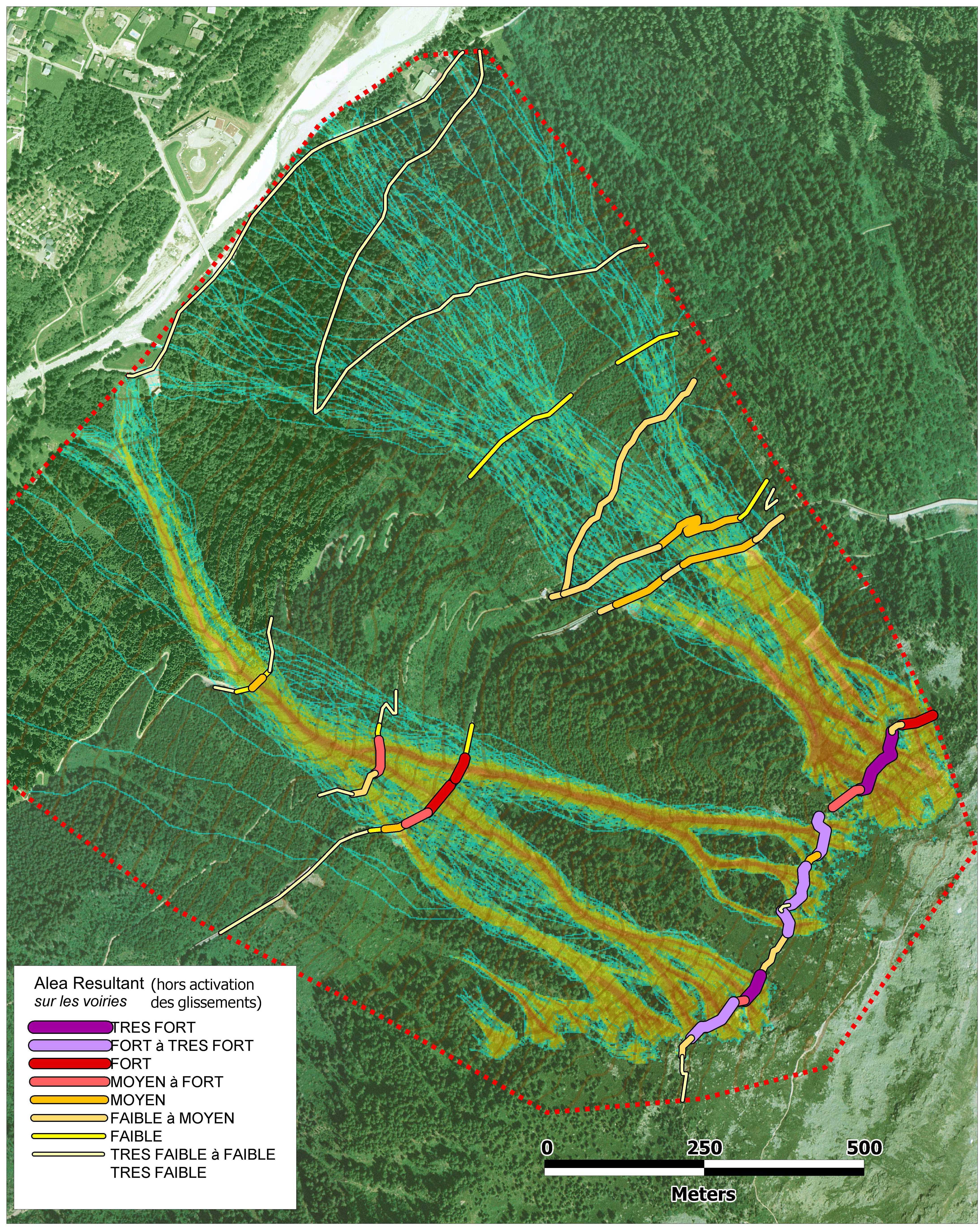
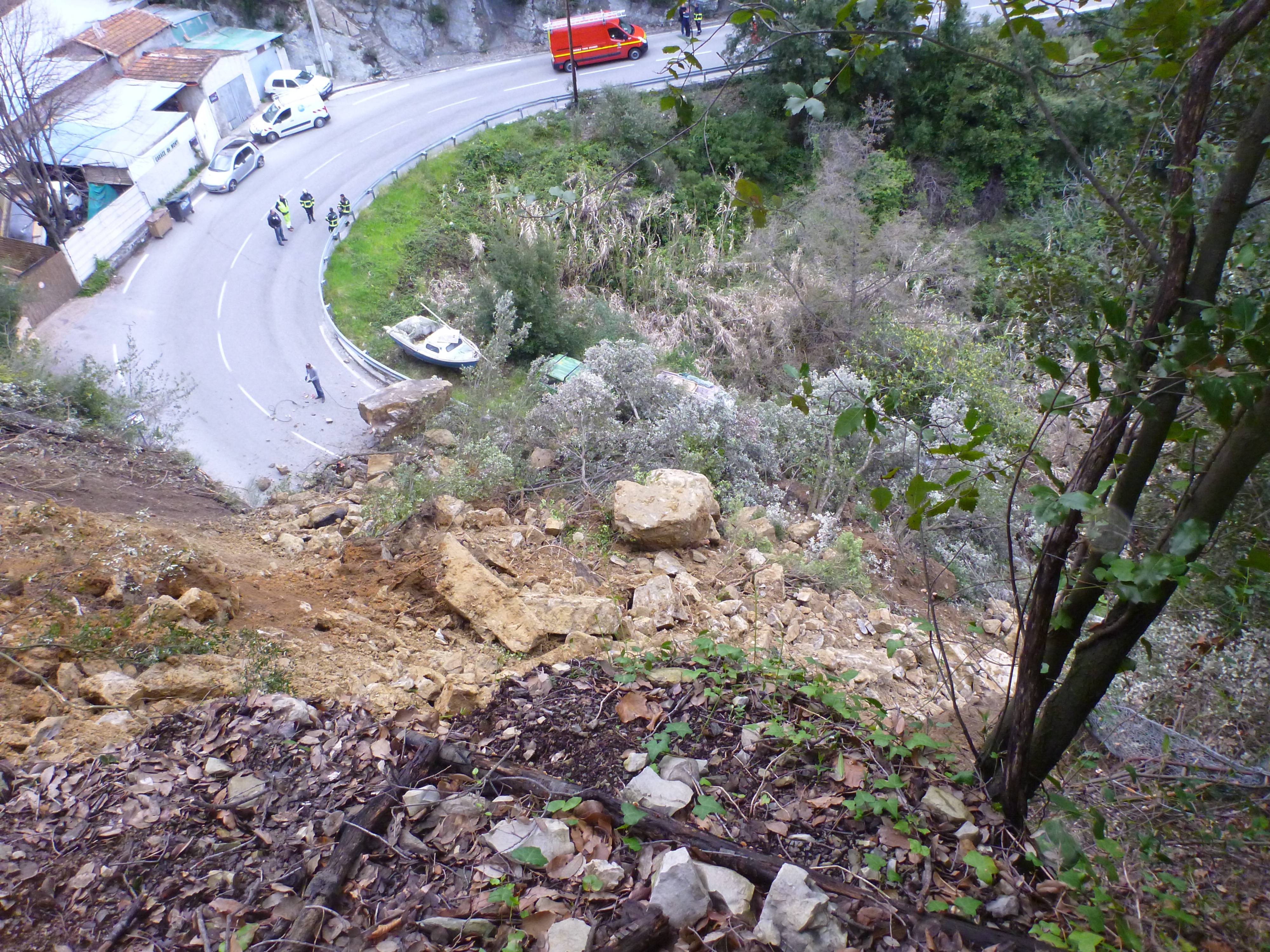
GÉOLITHE est intervenu en urgence sur le glissement routier affectant la RD6 sur Passy.
Suite au diagnostic d’urgence une mission mobilisant ses moyens en géotechnique et géophysique été confiée par le CG74
Oil & gas, deep storage
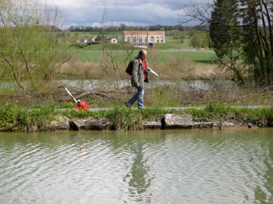
Geophysical prospecting
All methods In France and abroad
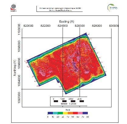
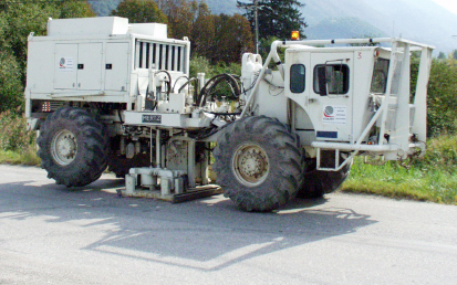
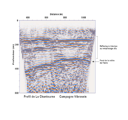
Vibro-seismic campaigns
Engineering
Geological and geophysical Studies Hydrogeological studies Sub-surface and deep geophysical prospecting Incidence notice Impact studies
Induced seismicity
Measurements, processing and interpretation
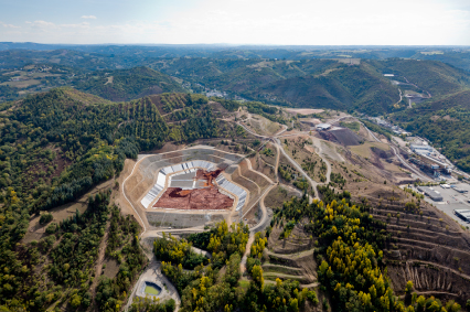
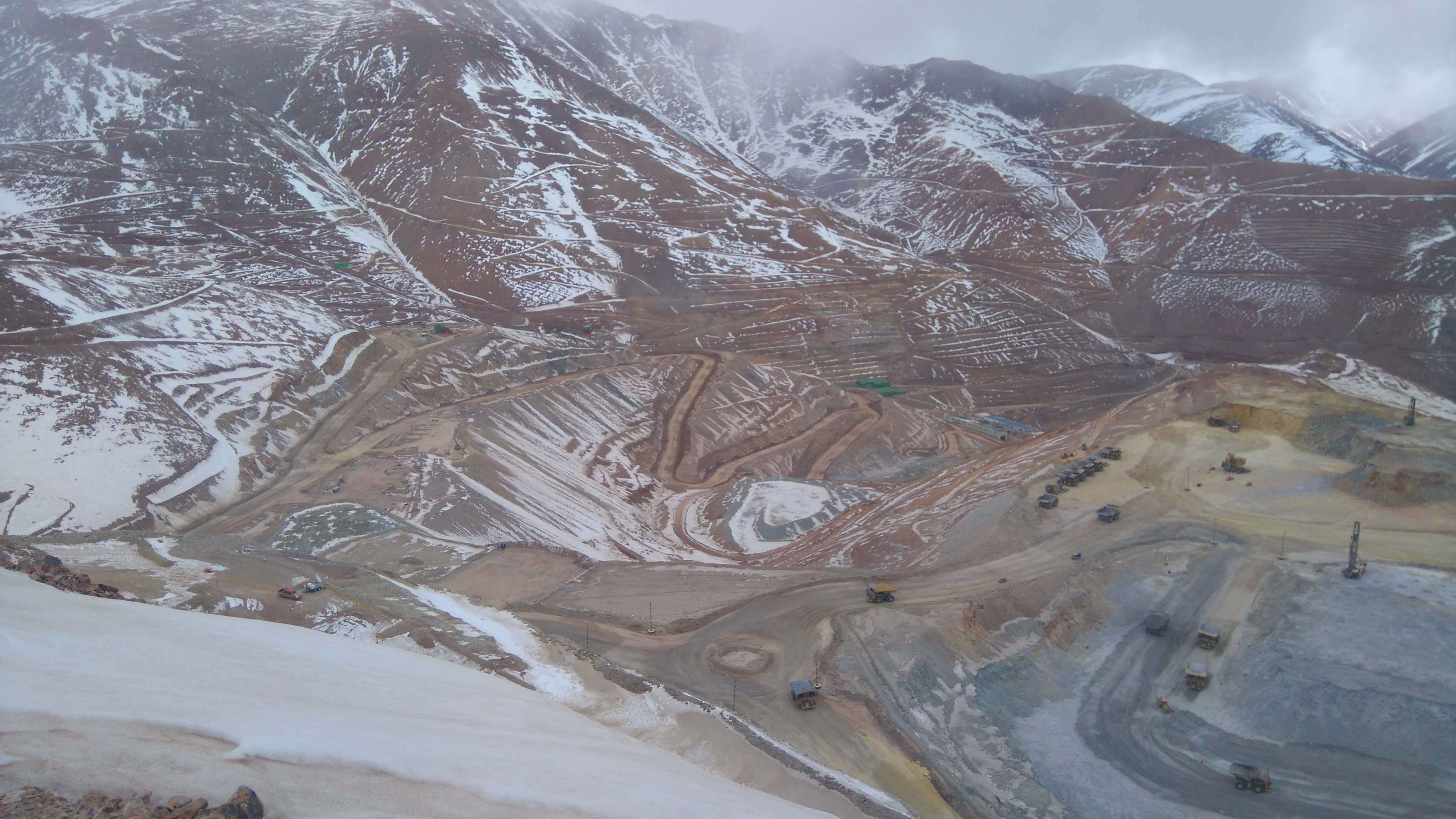
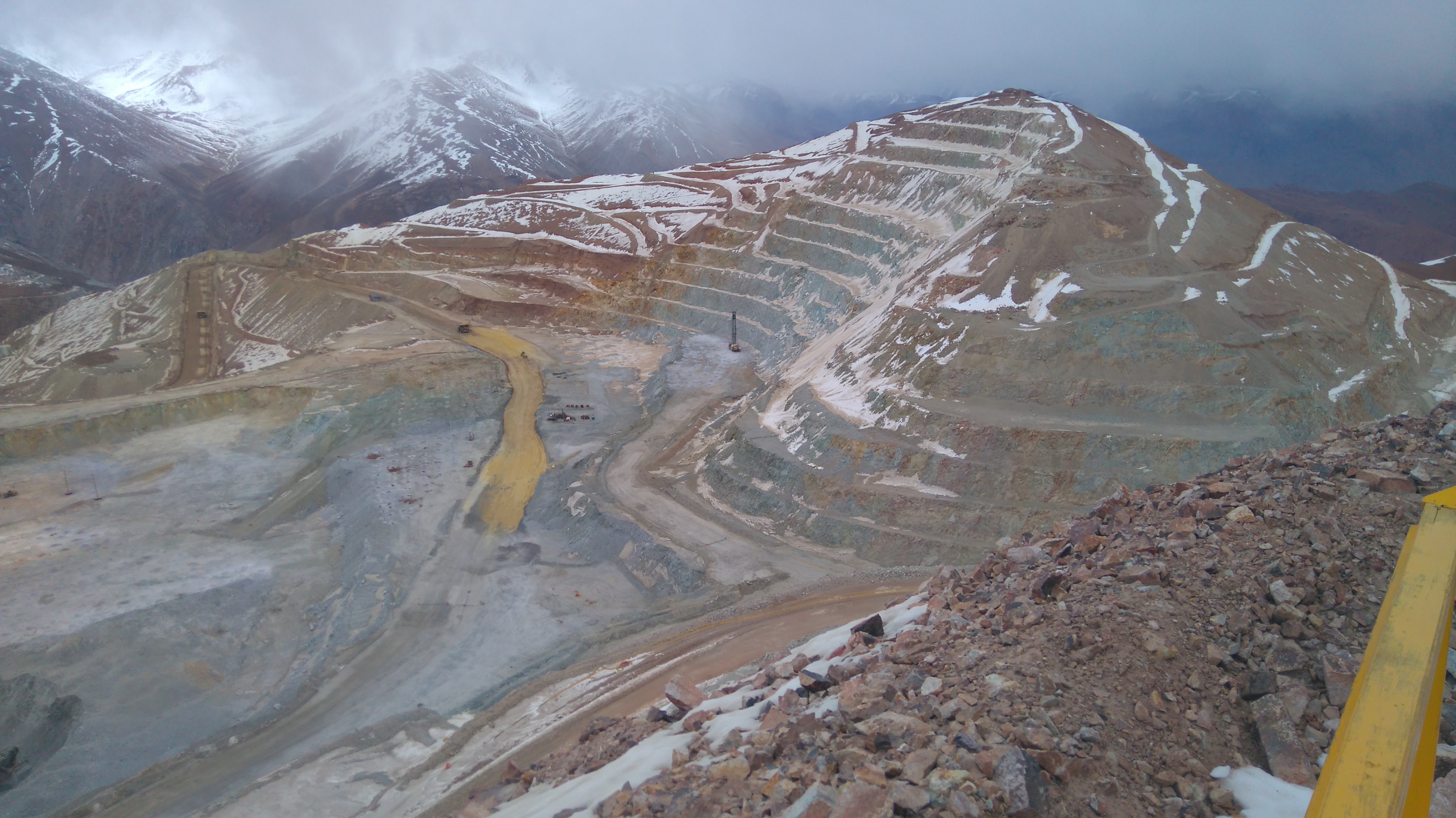
Mines
Geological and geophysical prospecting
- Geological detail mapping
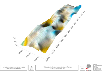
- Geophysical prospecting (down to 1000 m in depth): Seismic reflection, etc.
- Probing, in-situ and in laboratory testing.
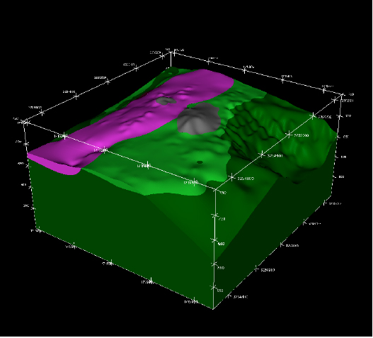
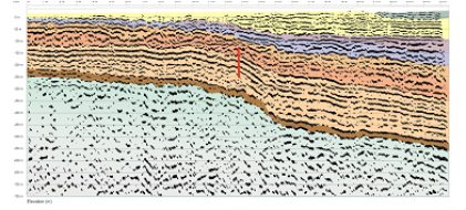
Development of a geological model
- Development of a 3D geological model from field data, drilling data and geophysical cross-sections.
- Geolithe has the program Geomodeller-3D.
Quantitative evaluation of environmental impacts
- Vibrations and over-pressures
- Projections, dusts Waters (balance, circulation, modelling, etc.)
Studies of the protection against gravity induced hazards
- Rockfalls
- Landslides
- Collapses
- Avalanches
- etc.
Securing and layout of sites
- Consolidation of walls
- Restitution
- Monitoring
Calculations of stability and sizing of works
- Galleries, tunnels
- Buildings, industrial structures.
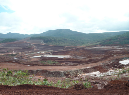
Quarries
Quantitative and qualitative evaluation of alluvial or rocky deposits
Detailed geological studies
Geophysical prospecting
Surveys, in-situ and in laboratory studies
Quantitative evaluation of environmental impacts
Vibrations and over-pressures
Projections, dusts
Waters (balance, circulation, modelling, etc.)
Impact studies
Development of a geological model
Development of a 3D geological model from field data, drilling data and geophysical cross-sections.
Geolithe has the program Geomodeller-3D.
Mining consultancy and Engineering
Design of shot plans
Reduction of nuisances.
Securing and layout of sites
Stability studies
Study of protection against gravity based hazards (rocky collapses, landslides, etc.)
Restitution
Monitoring.


Water
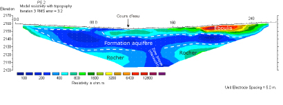
Identification of water resources
Surface and underground drinking water
Search and evaluation of new water resources
Geological and geophysical Studies Hydrogeological studies Sub-surface and deep geophysical prospecting Incidence notice Impact studies
Video inspection of wells and drill holes
Colour camera with rotatable and orientable head
Monitoring of subterranean waters
Automatic remote measurements Data management
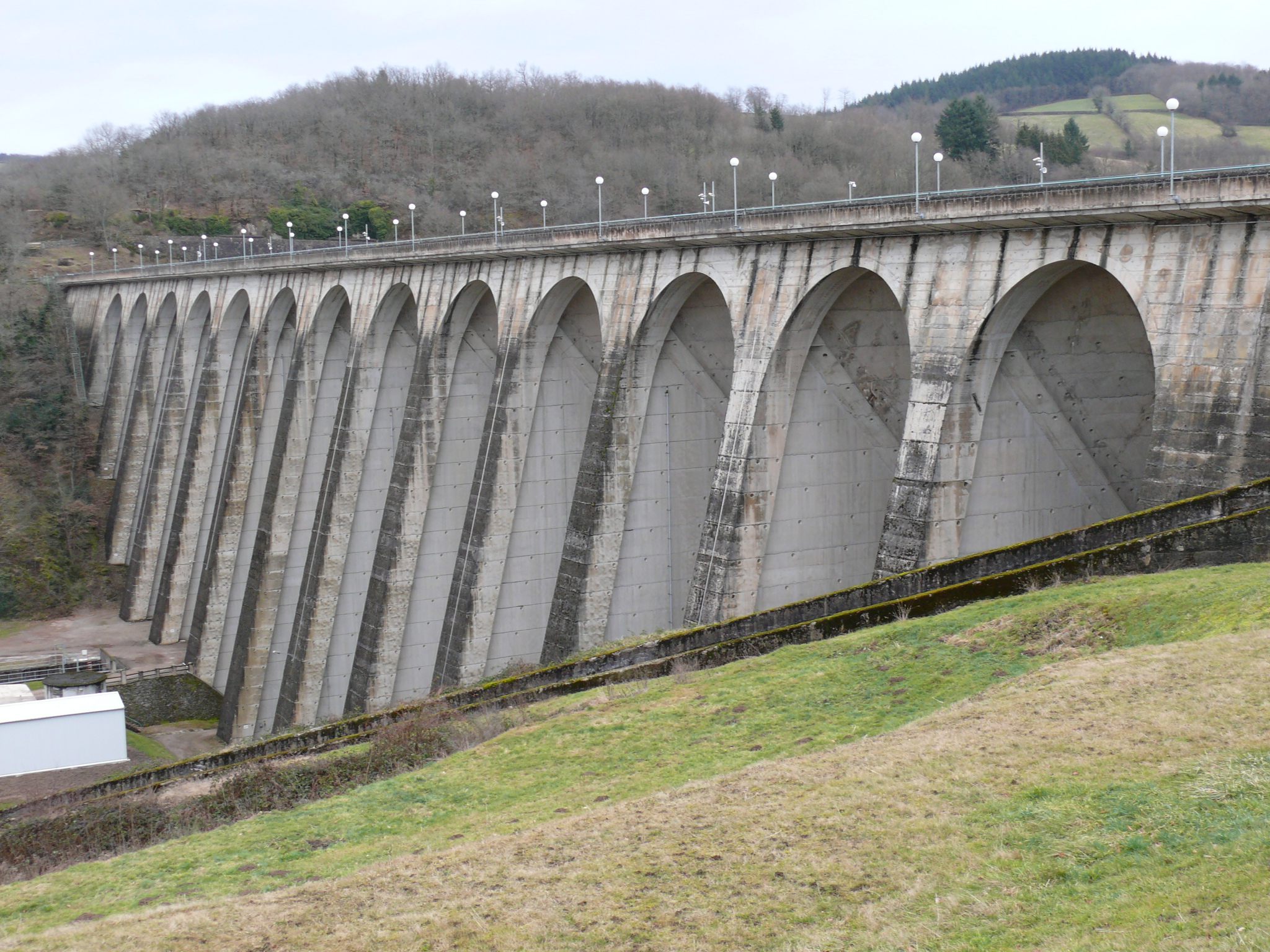
Retention basins and dams
GEOLITHE is accredited for studies, diagnoses and monitoring of works on sea-walls and small dams.
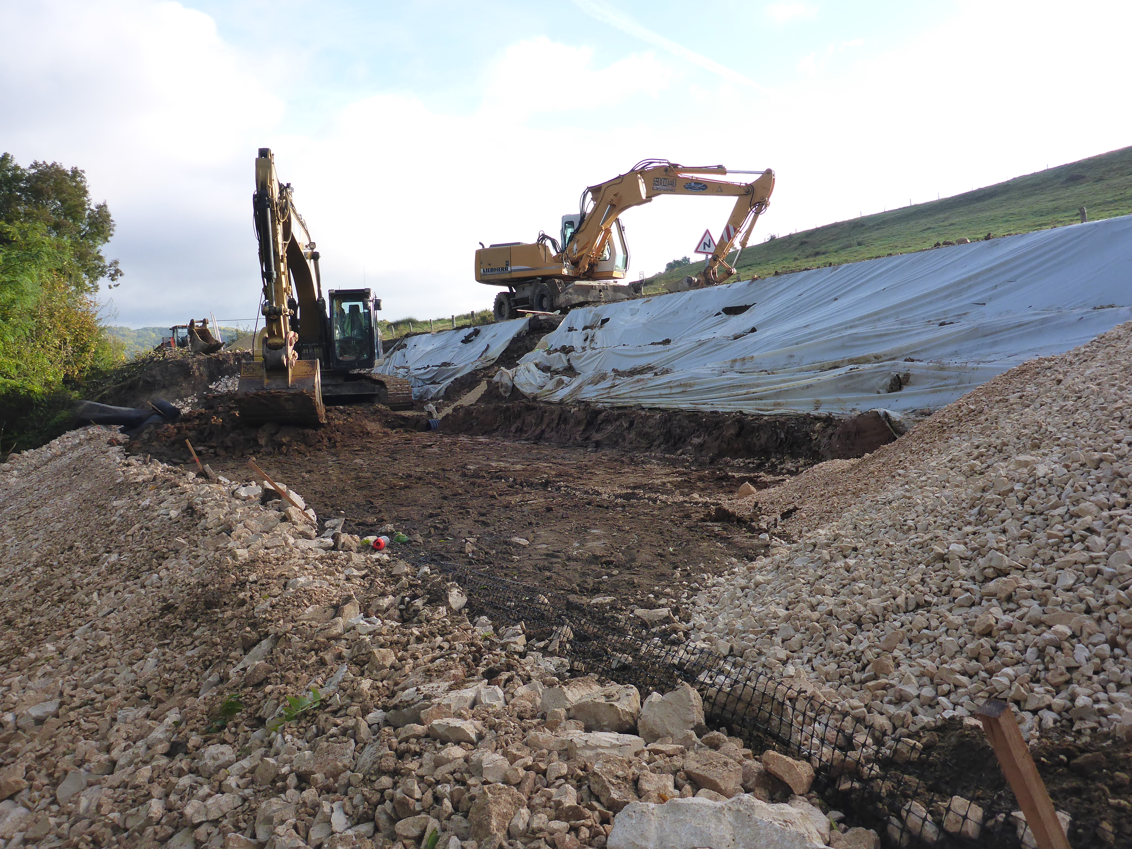
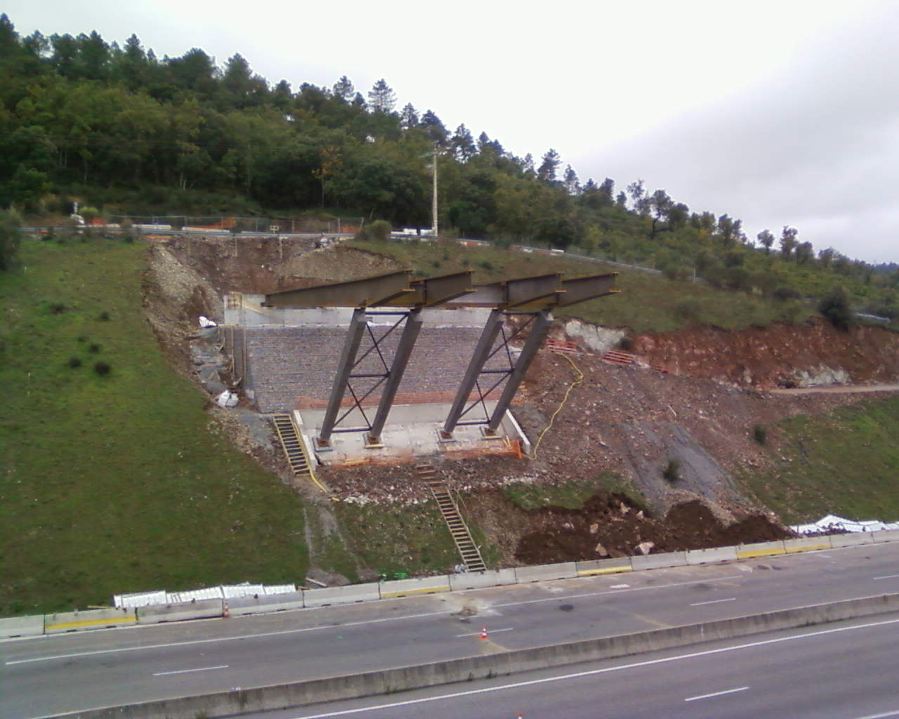
Linear infrastructures
MOTORWAYS, ROADS, RAILWAYS, TRAMWAYS, CABLE TRANSPORT, AIRPORTS
In the field of major earthworks, GEOLITHE brings its mastery of the methods of stability analysis of slopes of excavations, whether of soil or rocks, of elevations and compressible soil embankments and the calculation of settlements. The techniques of substitution processing (lightened elevations) or soil reinforcements in particular, are also more and more used.
Our know-how
- Specific geological and geotechnical expertise concerning routes and platforms, civil engineering, structural works, routed underground works, the analysis of the stability of excavations, loose or rocky; of the stability of embankments, calculations of the settling of platforms, soil substitution (lightened elevations), treatment of soil reinforcement.
- NFP94-500 geotechnical missions going from upstream feasibility phases (routing) to the phases of monitoring of the execution of works of platforms and associated geotechnical works.
- Instrumentation of geotechnical works, checking and monitoring of vibrations.
- Project management (design and realisation), external monitoring, project management assistance.
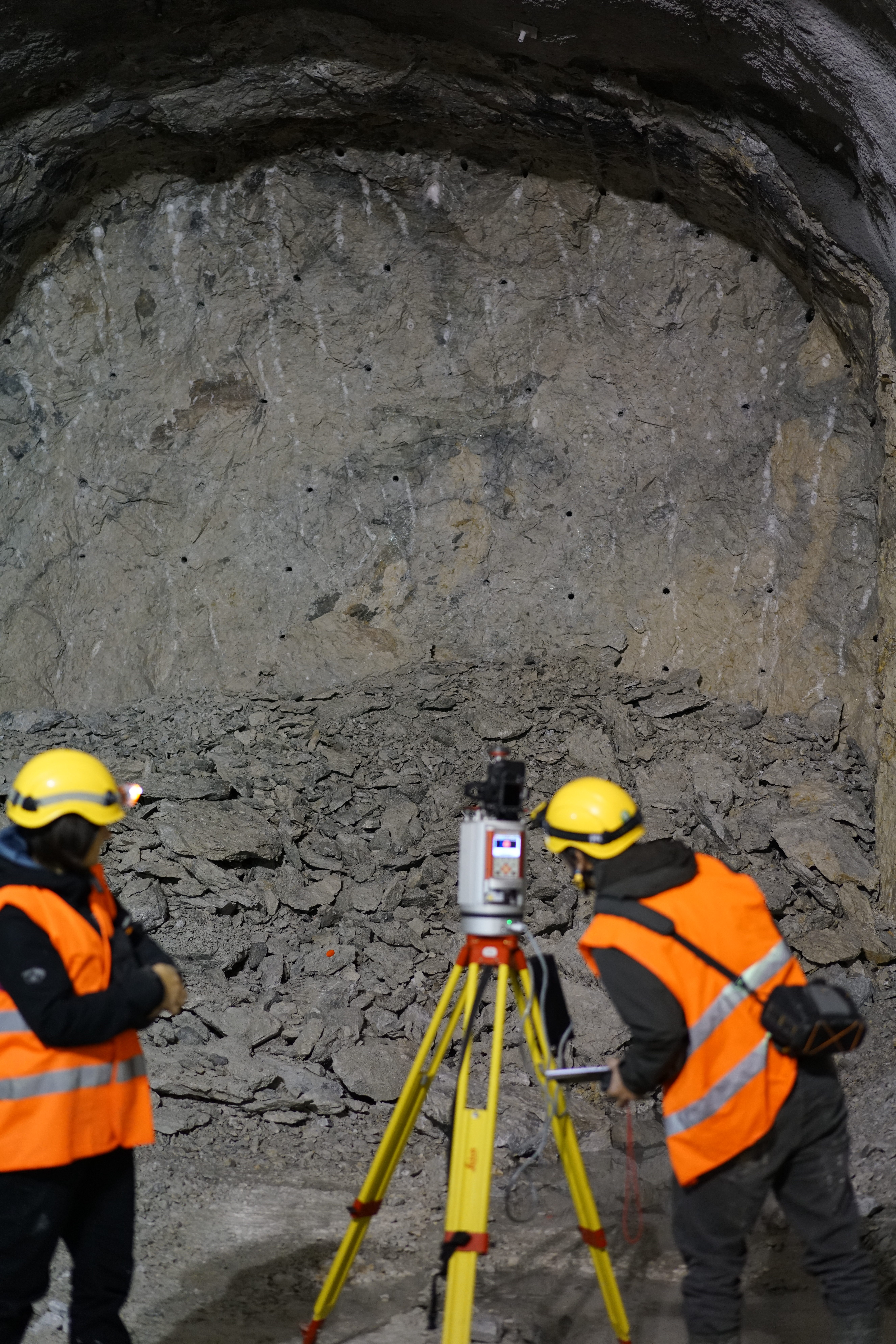
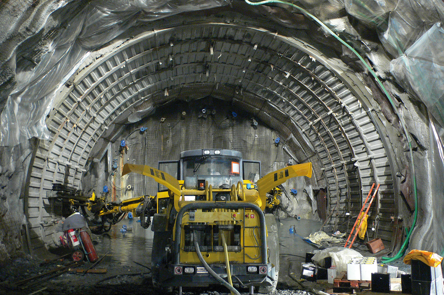
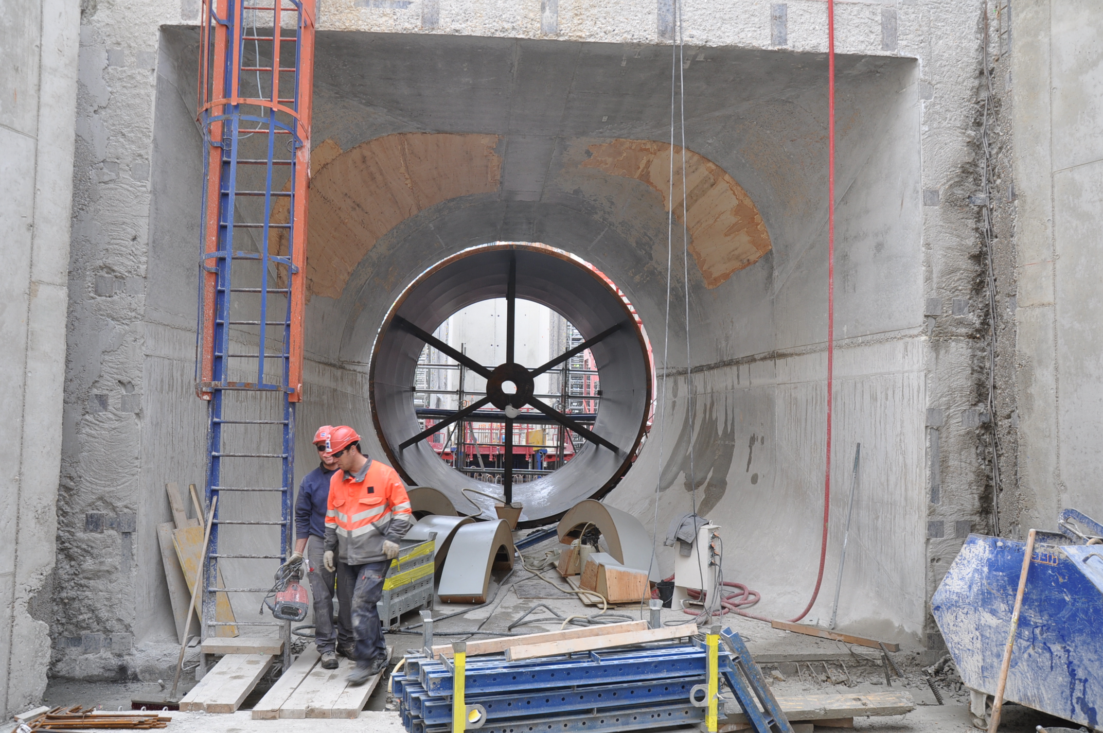
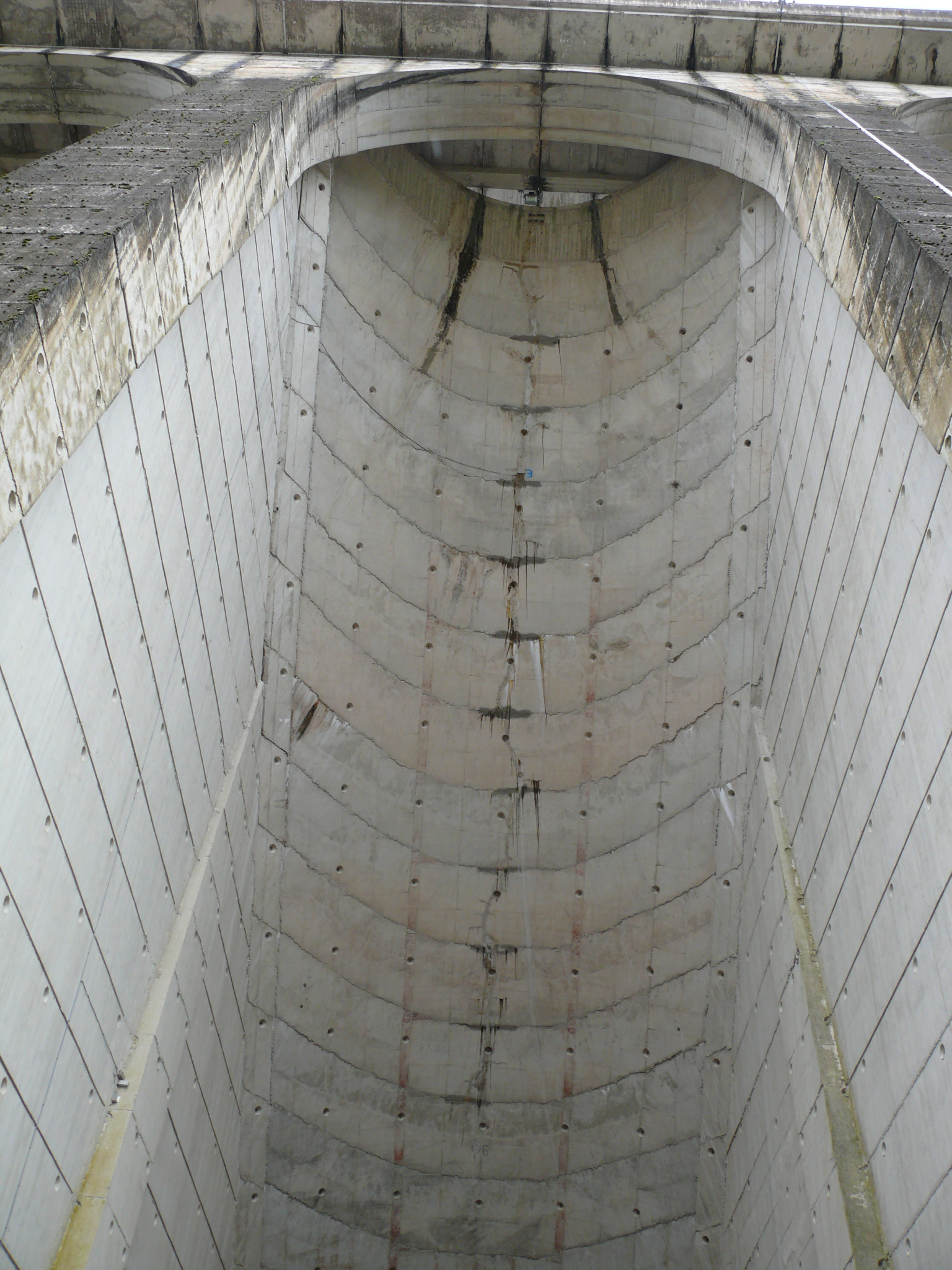
Underground works
underground works, underground cavities
Our know-how
- Creation of MSG and PMR documents;
- Studies, geological and geotechnical assessments, dimensioning;
- 3D geological modelling under GeoModeller
- Static and dynamic 3D modelling (Flac, Plaxis, etc.), execution studies;
- Geological monitoring during works
- Diagnostics, detailed inspection;
- Instrumentation, monitoring and follow-up of vibrations;
- Project management (design and realisation), external monitoring, project management assistance.
Levé géologique laserscanner

Prospection Géophysique
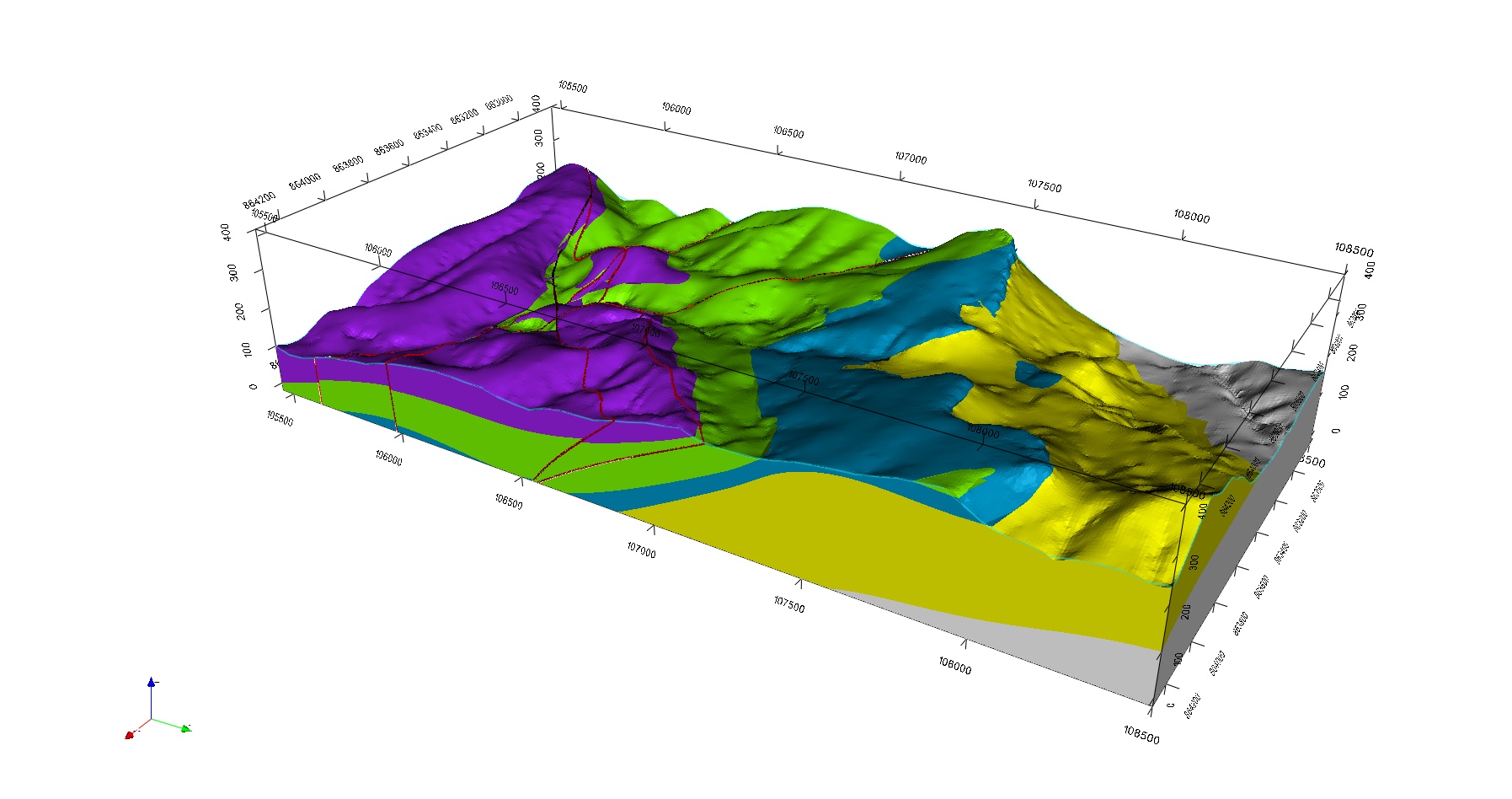
Modélisation géologique sous GEOMODELLER 3D
Expertise, contrôle, Ass. à maîtrise d’œuvre

Suivi géologique de tunnel
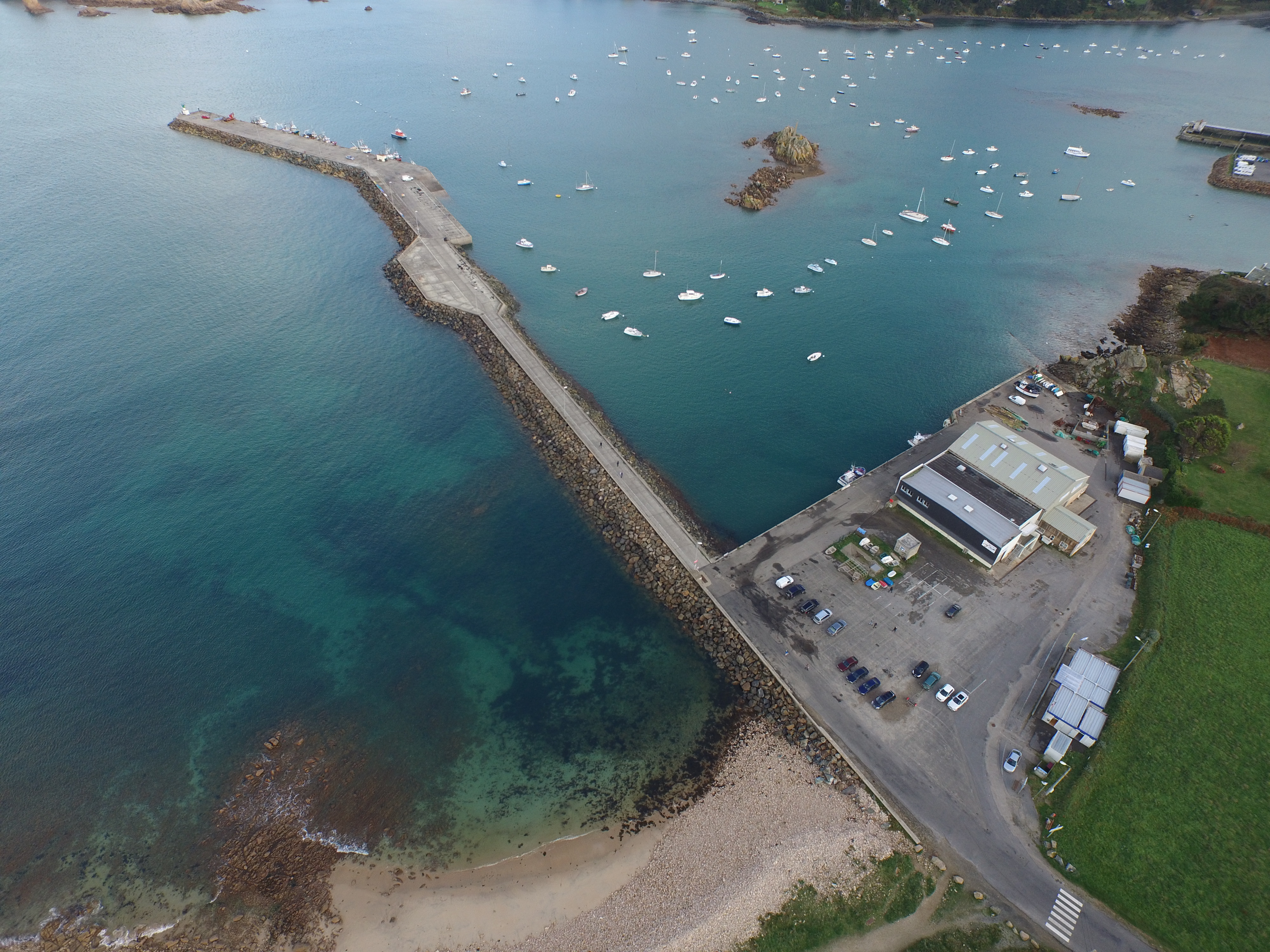
Maritime and fluvial works
dams, seawalls, jetties, canals, ports, riverbank layouts
GEOLITHE performs geotechnical and hydrodynamic studies, missions of assessment and project management of consolidation of hydraulic structures. In addition, GEOLITHE is accredited under the decree 2007-1735 of MEDD (Ministry of Ecology and Sustainable Development) to perform missions of assessment and project management on hydraulic structures such as seawalls and small dams.
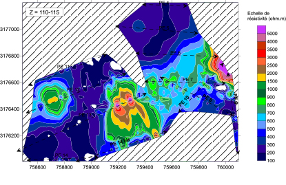
- Terrestrial and aquatic geophysical reconnaissance: seismic refraction, electrical panels, electromagnetic, radar
- Geotechnical reconnaissances: mechanical shovel probing, dynamic cone penetrometer, pressuremeter probing, coring
- Laboratory testing: identification, geomechanical tests, oedometer tests, (compression studies)
- Geological and geotechnical assessment of structures, analysis and evaluation of induced deformations,
- Modelling of internal flows, taking into account of hydrograms of floods
- Study of external and internal stability, analysis of flows and hydraulic gradients
- Management of specific stresses ( erosion, periodic flooding, rapid draining, internal erosion)
- Initial safety diagnoses
- In-depth technical inspections
- Development of structural dossiers, of written instructions
- Studies of danger
- Studies of the quantification of rupture hazards
- Studies of the definition of consolidation modes

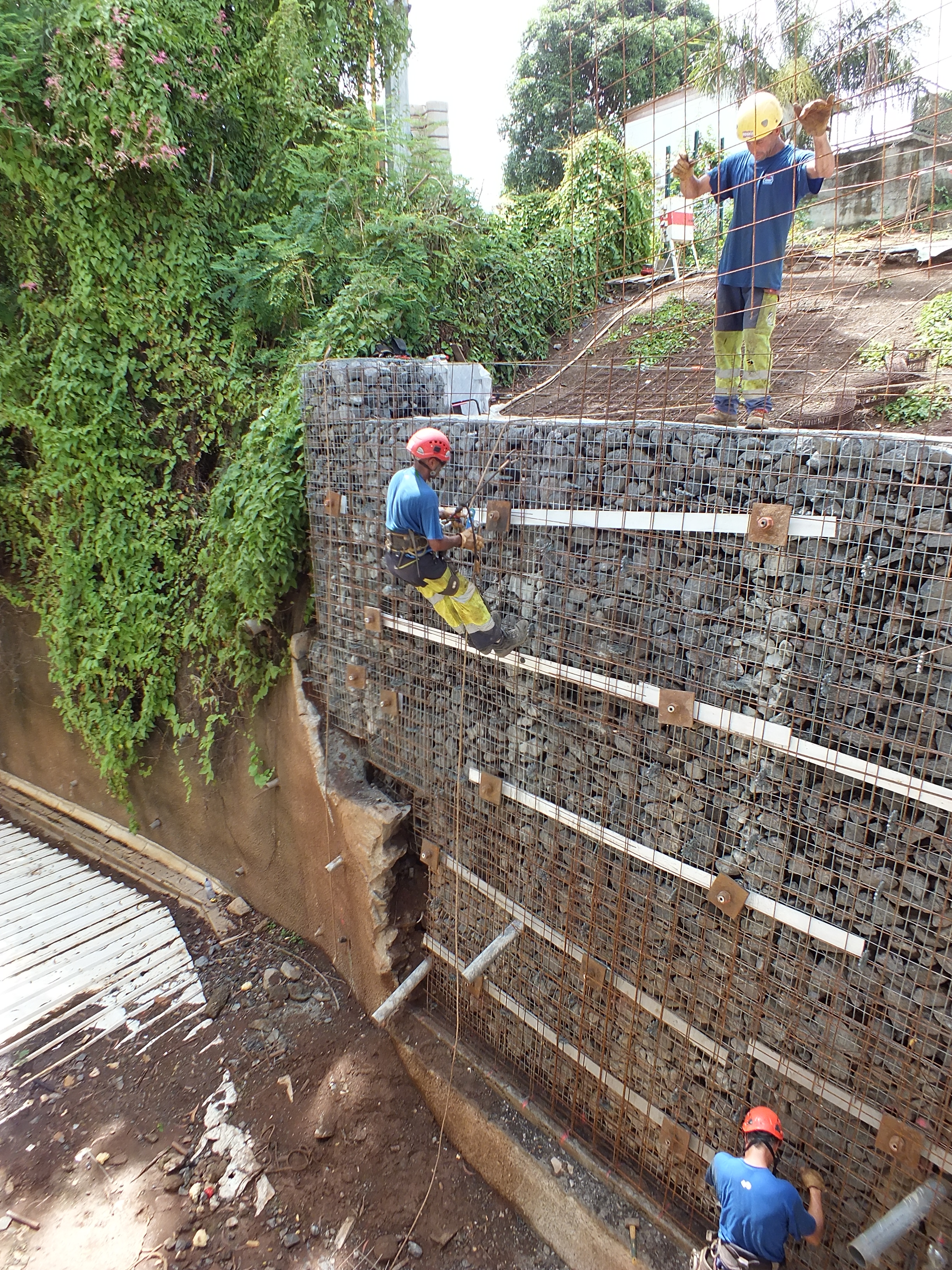
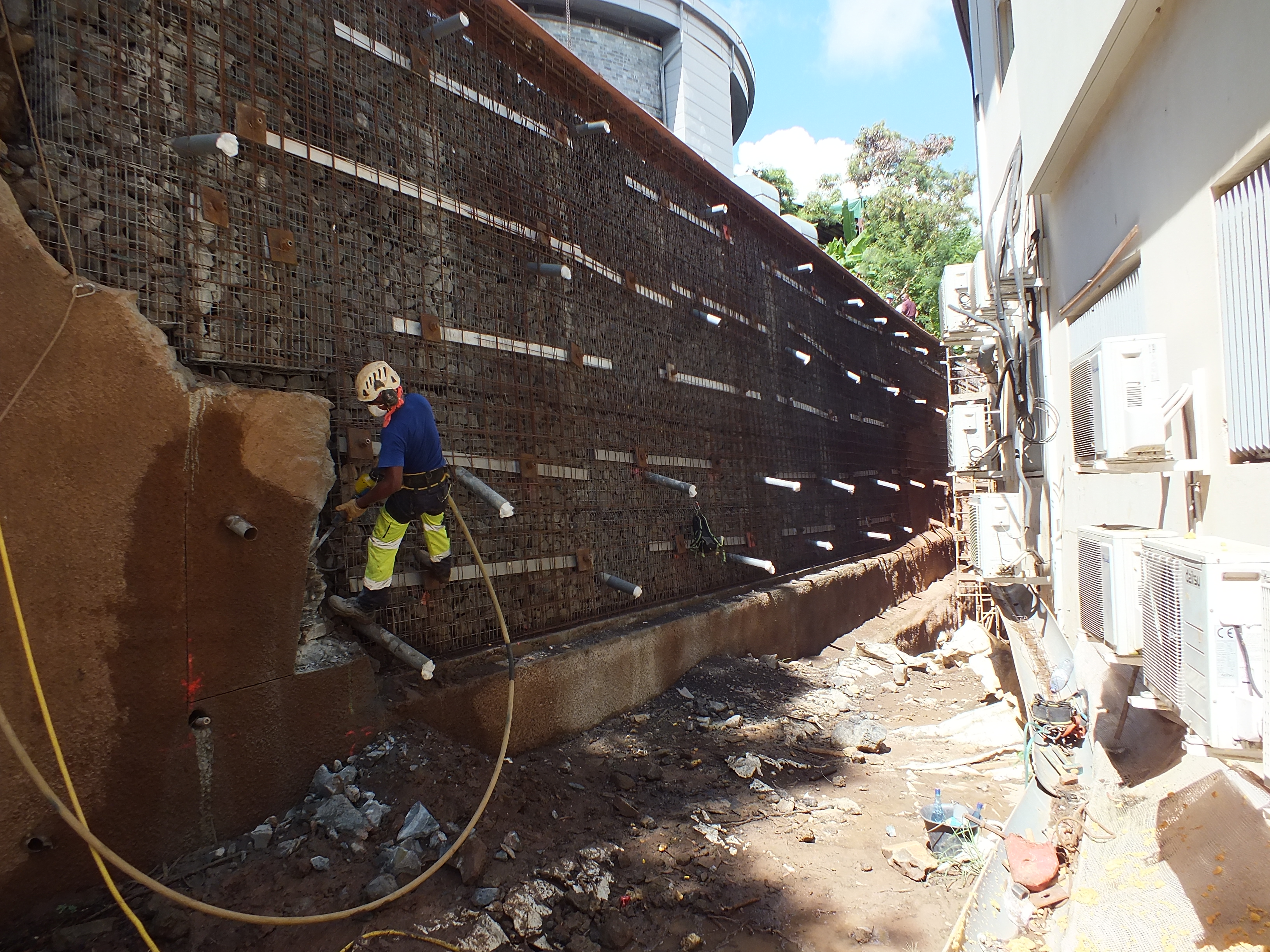
Urban and industrial infrastructures
buildings, networks, malls, industrial zones, household and inert waste storage installations
- Geological and geotechnical assessments
- terrestrial geophysical reconnaissance
- analysis and evaluation of induced deformations,
- calculations of stability, instrumentation, etc.


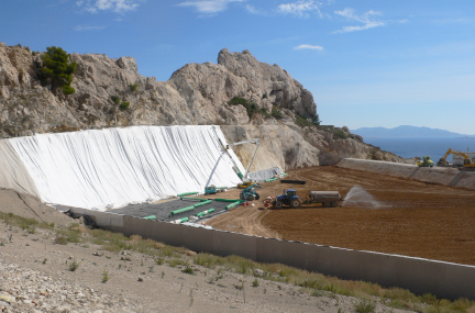
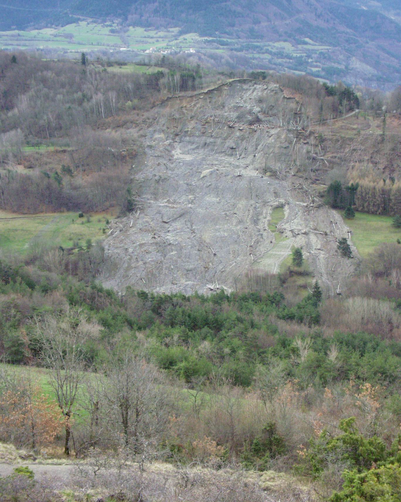
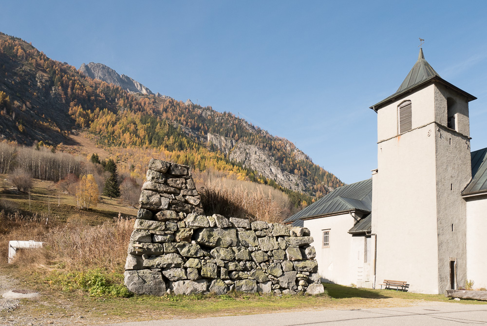
Rockfalls
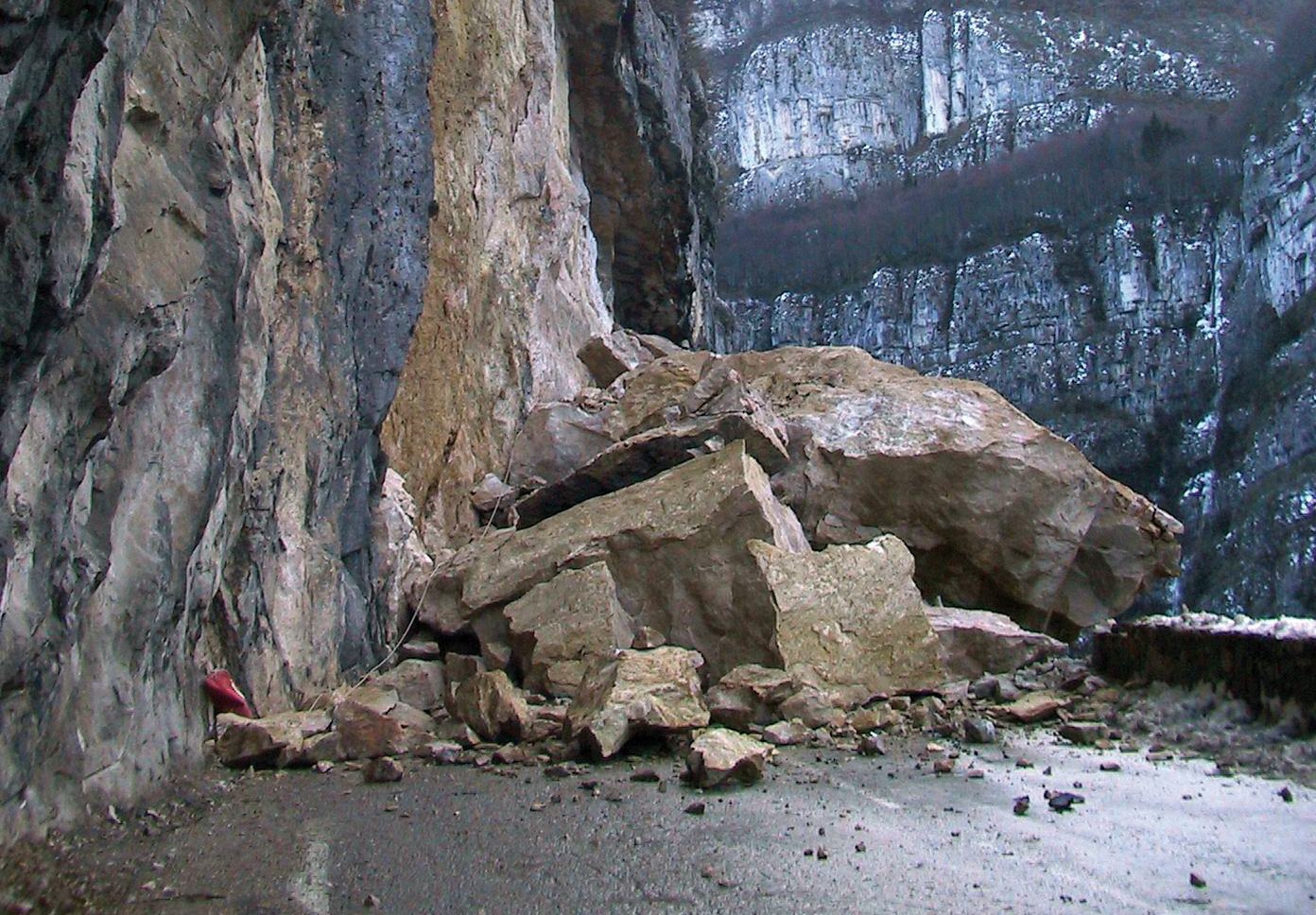
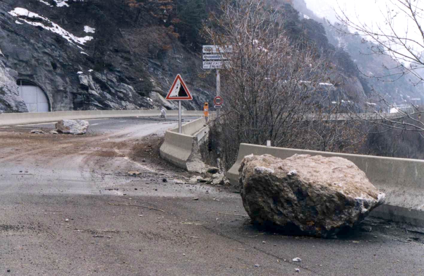
Rock-slides are rapid and brutal gravitational phenomena involving the movement of material of greater or lesser degrees of homogeneity. It is by the multiplication of issues (communications routes, zones of habitation, industrial zones, structural works, etc.) that these phenomena produce damage to persons and property nowadays.
Since 1992, GEOLITHE possesses all the experience and skills necessary for the study and assessment of these phenomena.
GEOLITHE provides contractors with personnel qualified and accredited to move about in difficult access environments.
Our teams of engineer geologists, geotechnicians high mountain guides, intervene in-situ, in order to establish a geological and morphological diagnosis specific to each study zone. They work autonomously using alpine techniques or with helicopters.
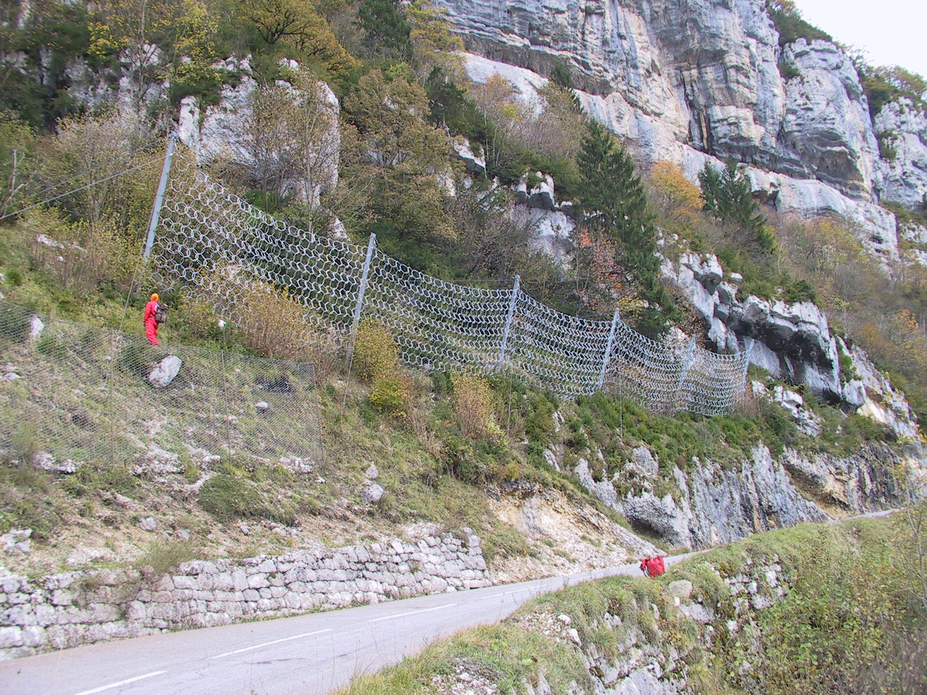
It is during in-situ reconnaissances that all of these phenomena and challenges are identified and characterised. The propagation must then be determined by trajectographic simulation or assessment. This approach allows therefore, the hazards of rockfalls to be determined and to propose protective counter-measures. These counter-measures are sized in the laboratory by trajectographic simulations and design calculations. Our permanent relations with works companies and their suppliers allow us to establish very realistic financial costs.
Our know-how
- Assistance to the Project Head
- Mission of project management and project management assistance
- Diagnostic studies, Pre-project, Project
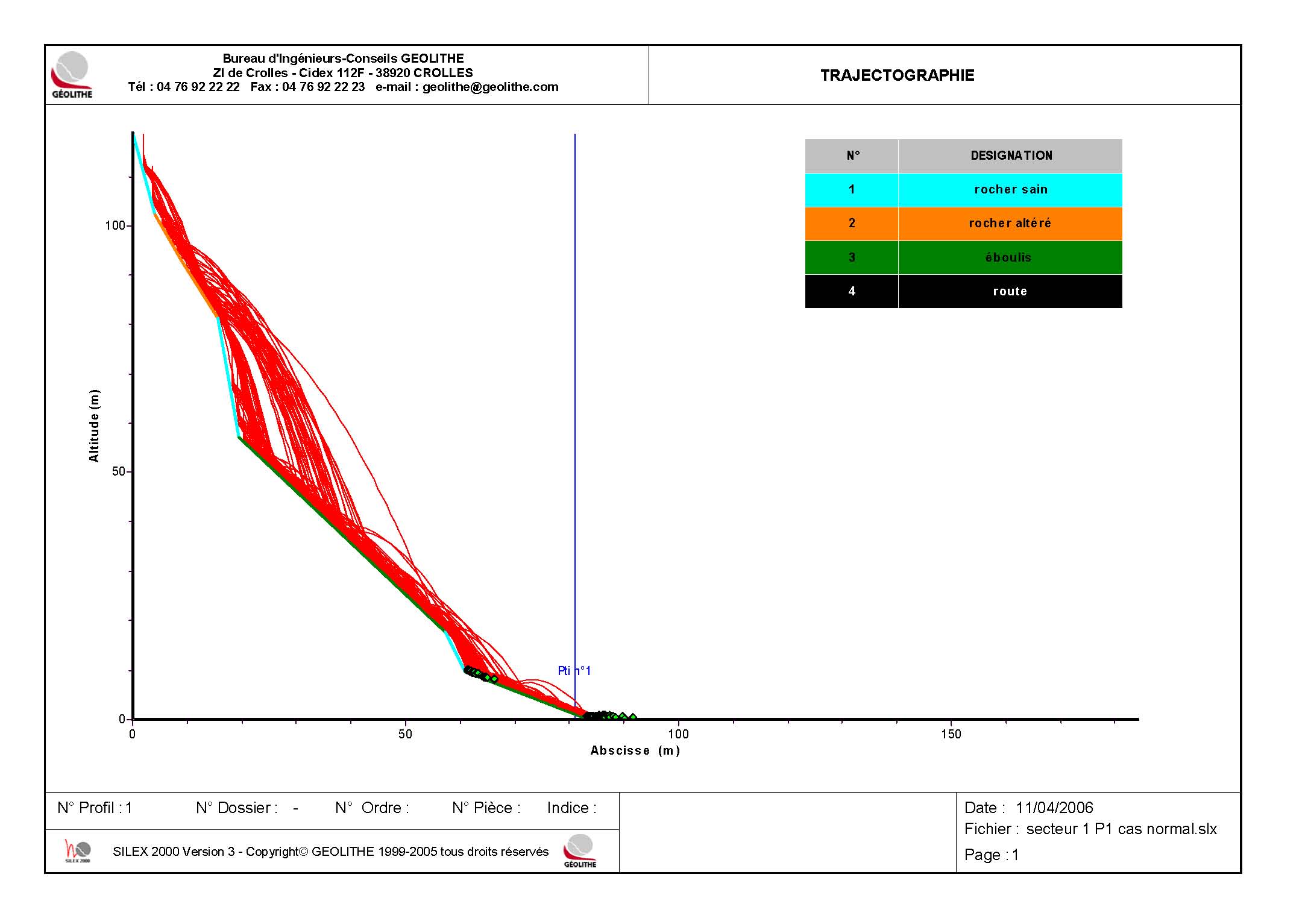
- Trajectographic simulation (Software Silex 2000, Rockyfor 3D)
- Establishment of hazards map
- Regulatory zoning
- Dimensioning of protective and consolidating structures (anchoring, barriers, mesh screens, protective walls, etc.)
- Follow-up and monitoring of works in the execution phase
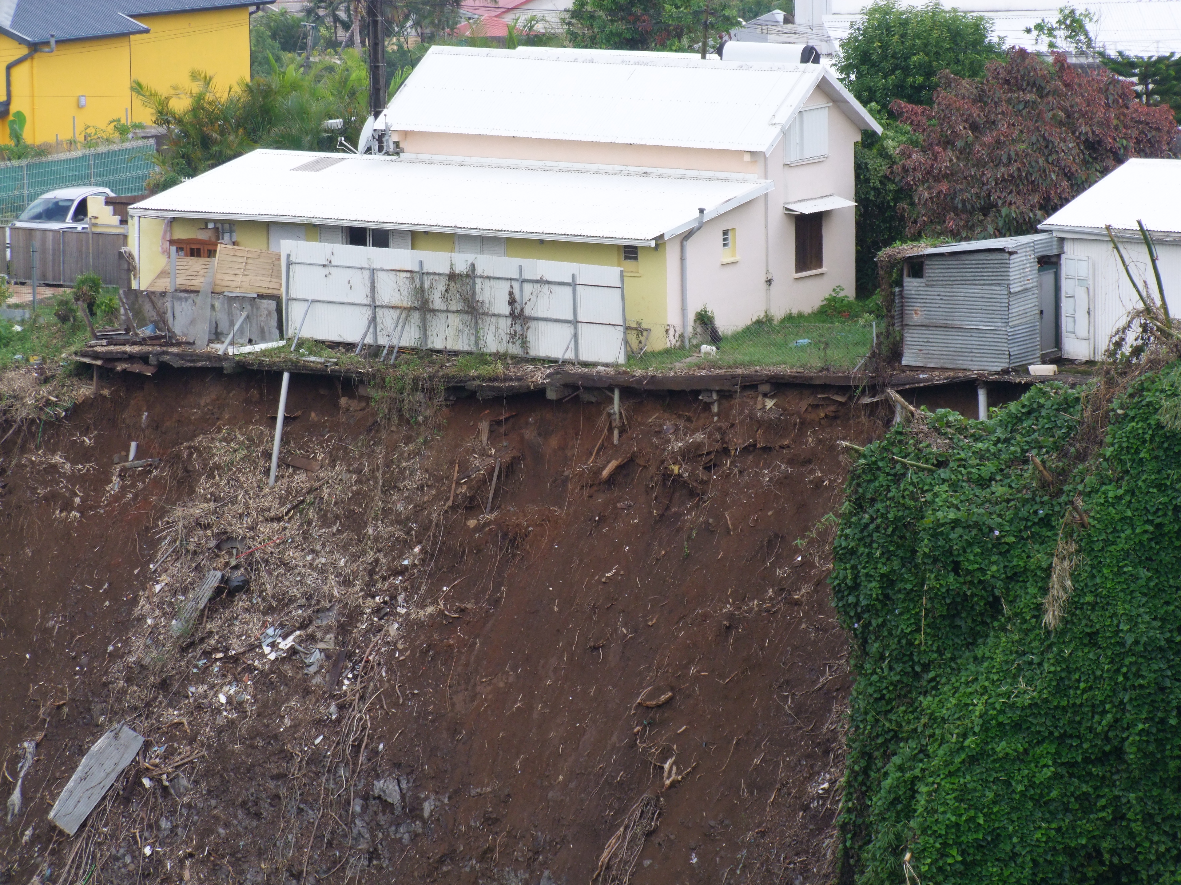
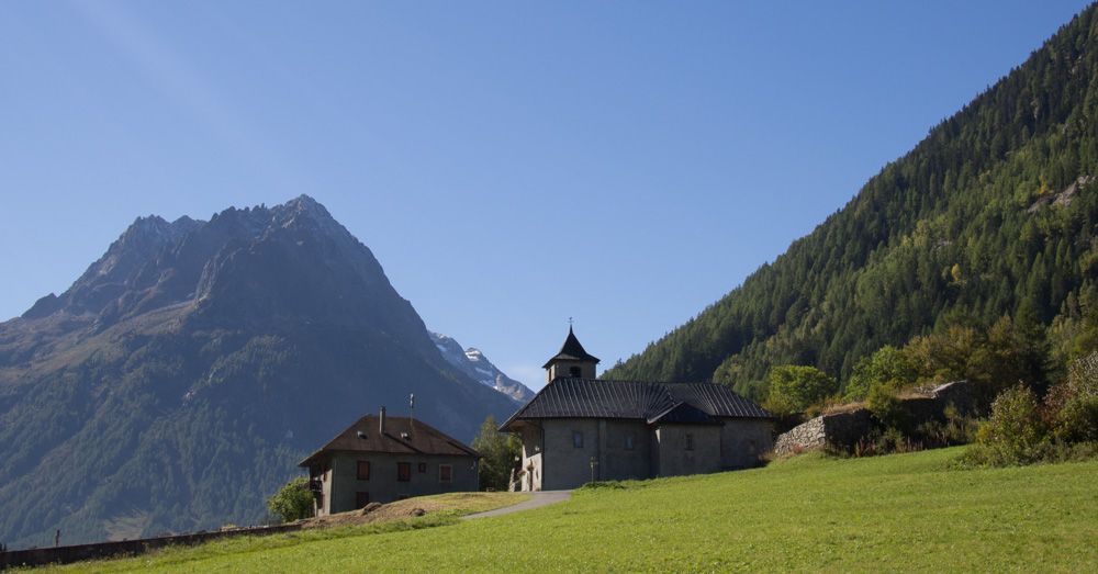
Landslides
Our know-how
Risk prevention studies
- Establishment of hazards map
- Regulatory zoning
Consolidation of landslides
- Geotechnical and geophysical reconnaissances
- Stability simulations
- Sizing of protective and consolidating structures
- Follow-up and monitoring of works in the execution phase
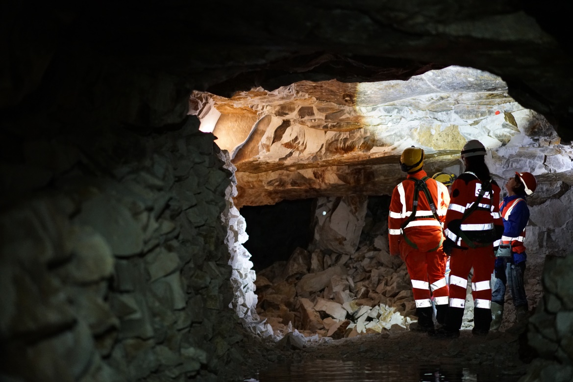
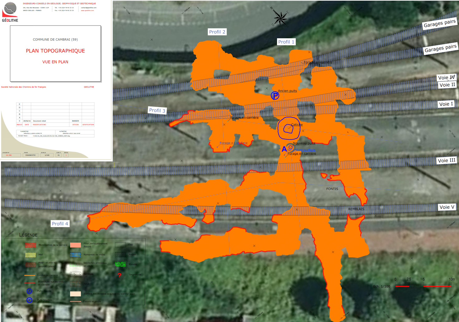
Underground cavities and mine hazards
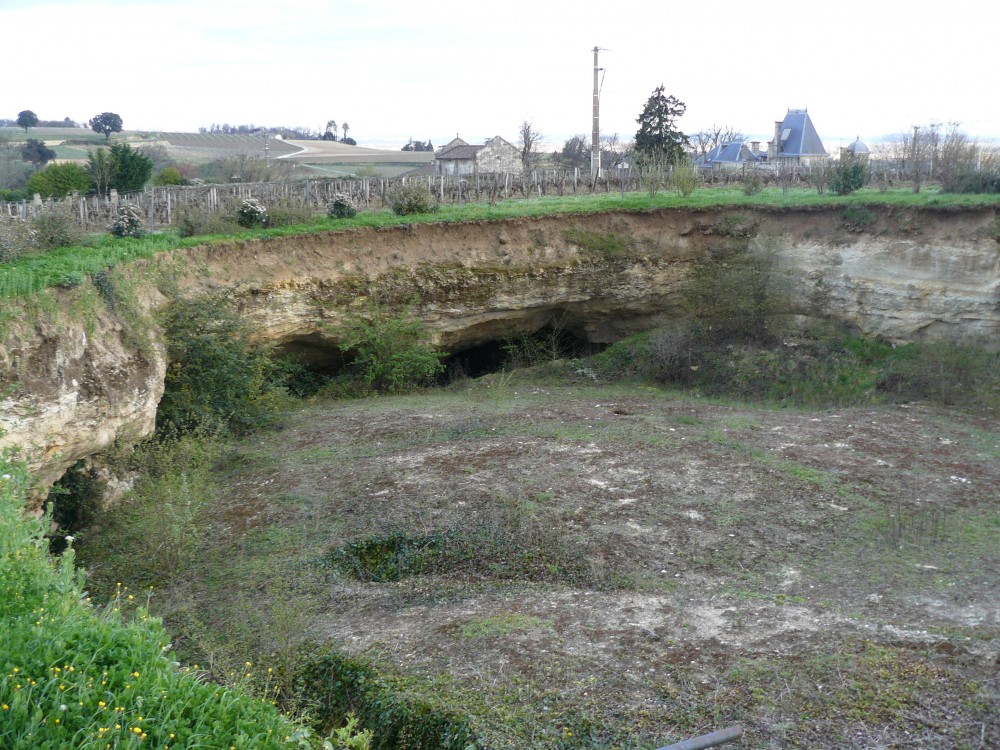 Our know-how
- Assistance to the Project Head
- Mission of project management, design and realisation of filling works
- Management of mining edifices, post-mining activity, filling in of cavities
- Establishment of hazards map
- 3D geological modelling
- Sizing of consolidation works (injection drilling, reconnaissance drilling, deep dams)
- Site instrumentation
- Securing of grottos for opening to the public
Coastal erosion
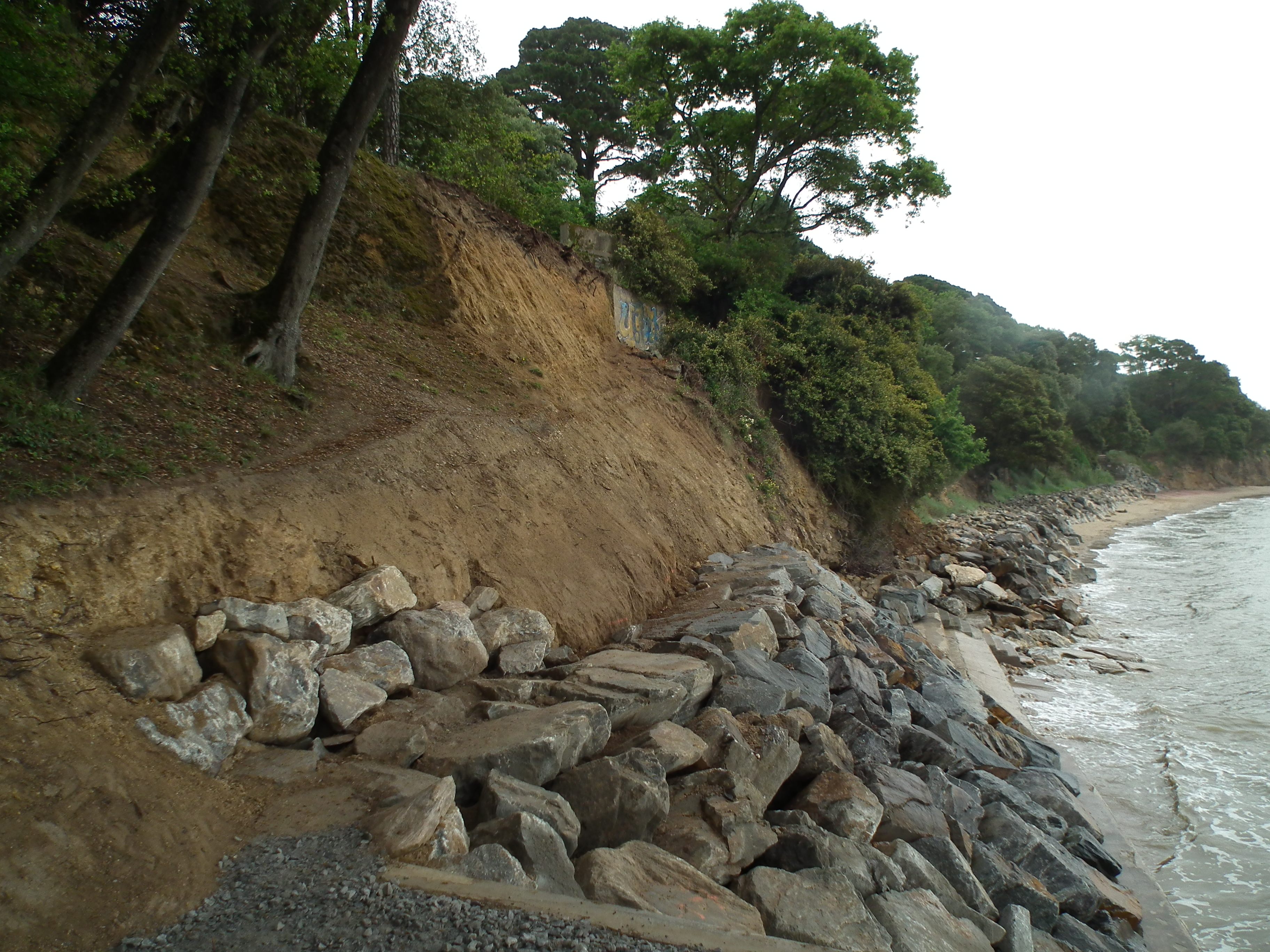
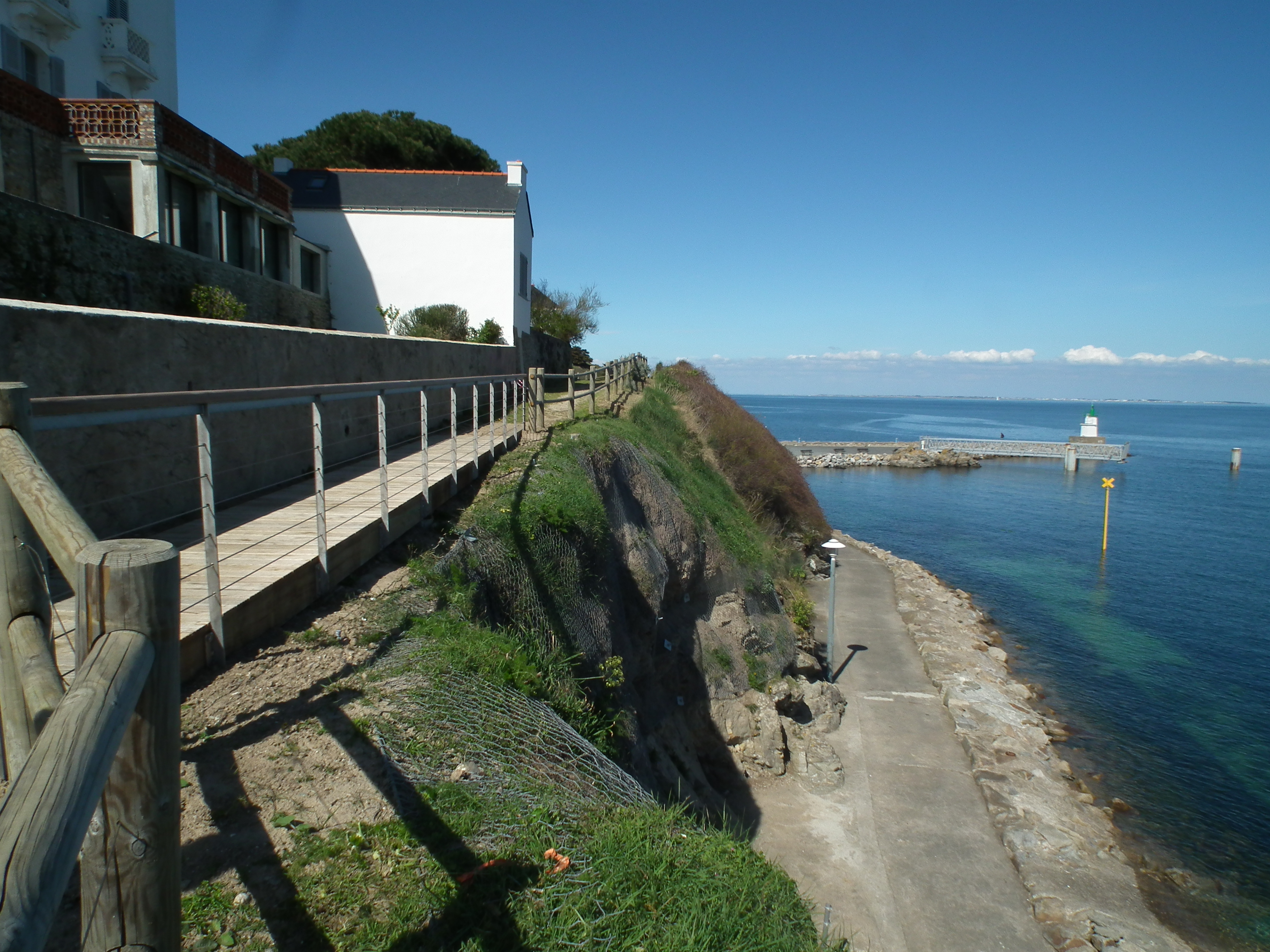
Our know-how
- Assistance to the Project Head
- Mission of project management and project management assistance
- Geotechnical and geophysical reconnaissances
- Sizing of protective structures against sliding, stone and rockfalls
- Sizing of sea defence structures
- Follow-up and monitoring of works in the execution phase
- Instrumentation of sites, cliffs
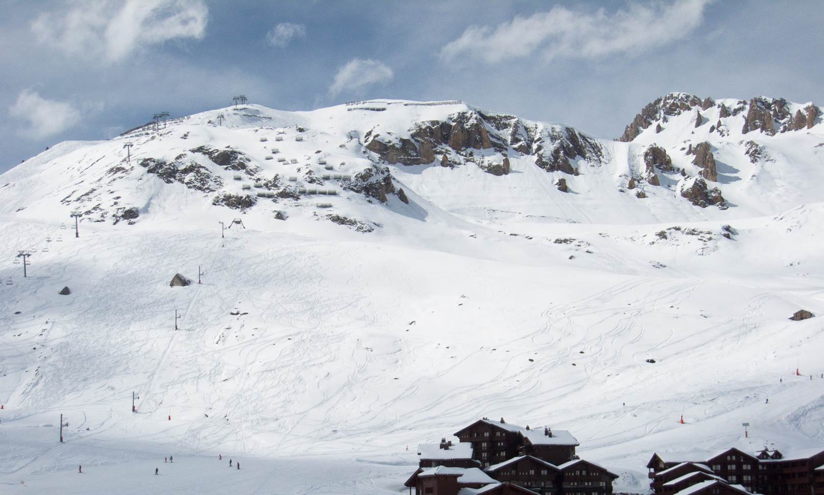
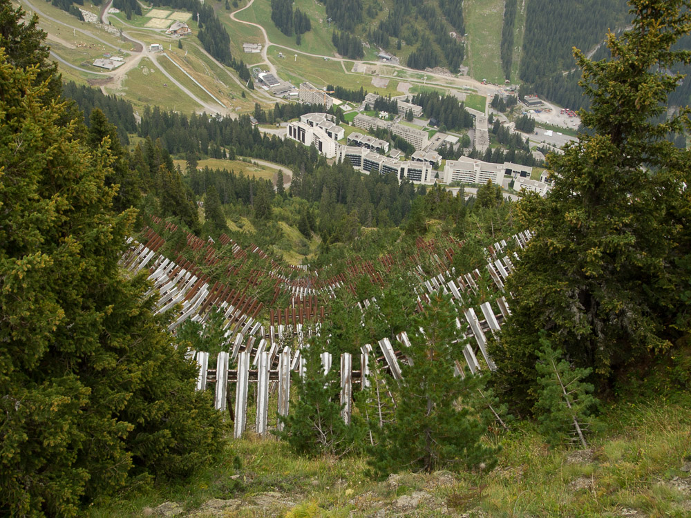
Risk and avalanche barrier construction

Protection d’itinéraires routiers
Avalanches are gravity induced phenomena presenting different types of flows It is by the multiplication of issues (communications routes, zones of habitation, skiable) that these phenomena produce damage to persons and property nowadays. Since 1992, GEOLITHE possesses all the experience and skills necessary for the study and assessment of avalanche phenomena. We bring you technical support depending upon your degree of risk acceptance, your degree of securing and the desired viability.
Our know-how
Characterisation of the phenomenon
- Assistance to the Project Head
- Mission of project management and project management assistance
- Study of the characterisation of hazards and in-situ risk analysis
- Acquisition and statistical analysis snow-conditions data
- Analysis and measurements of terrain,
- 2D Modelling of flows using Aval1D
Protection strategy and risk managemen
- Establishment of hazards map
- Regulatory zoning
- Multi-criteria analysis (technical, financial, viability, environmental, maintenance)
Design of passive and active protective structures
- Dimensioning of protective and consolidating structures (anchoring, barriers, grids, racks, deflectors, protective walls, avalanche galleries, etc.)
- R&D on automatic avalanche detection

Suivi pose barrière mono ancrage
Monitoring de site

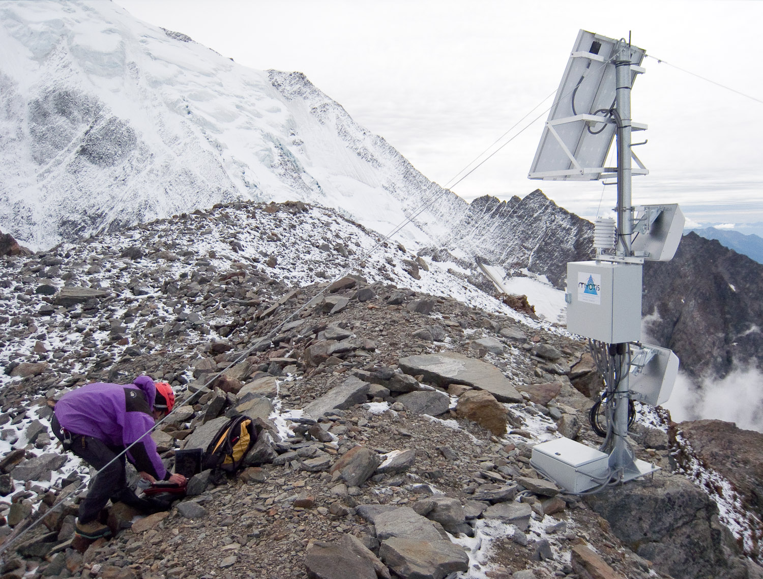
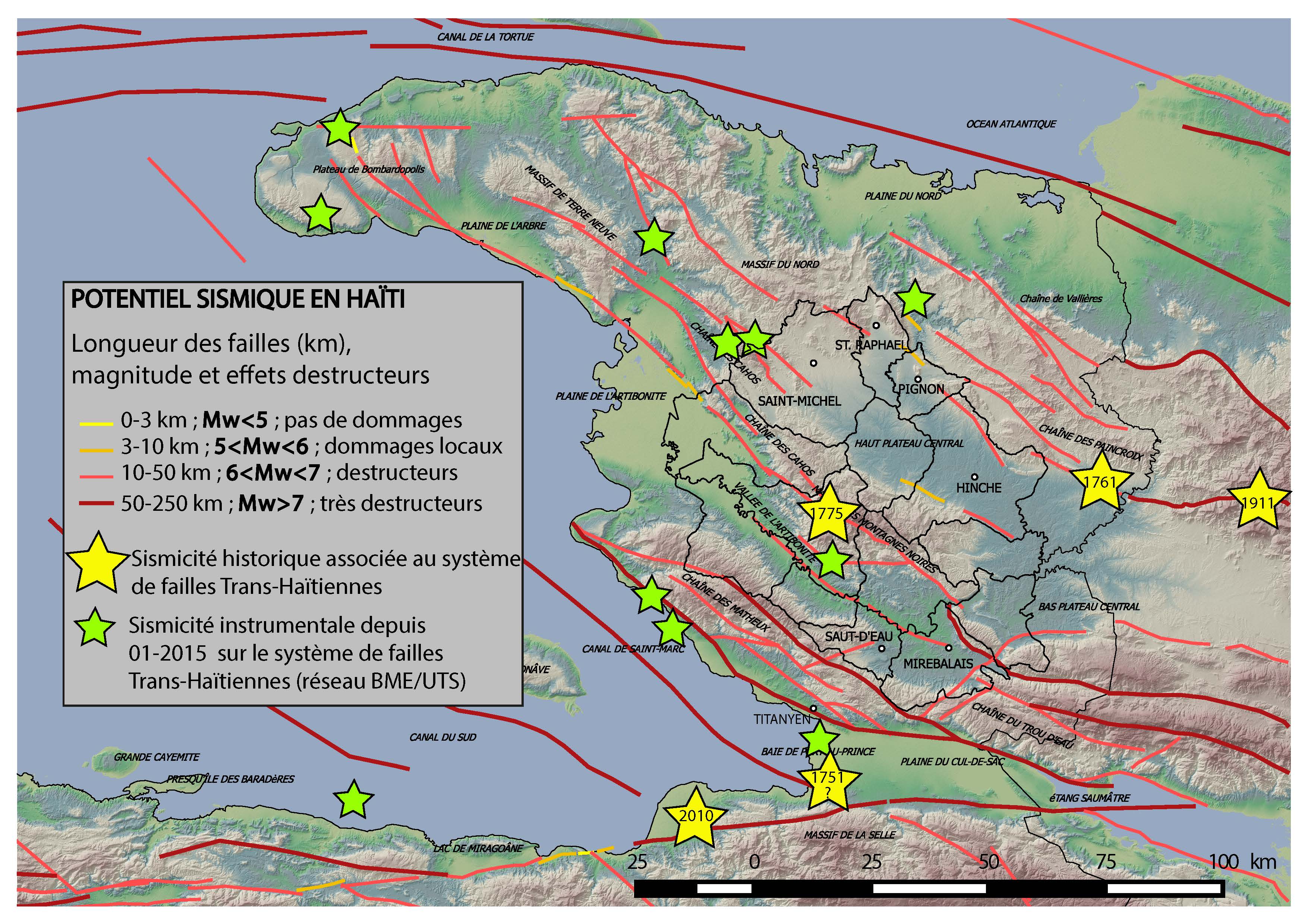
Seismic risk
Our know-how
Assistance for project management Mission of project management and project management assistance Diagnostic Studies, preliminary drafts, projects
- Establishment of seismic hazard maps
- Evaluation of seismic hazard by use of coupled probabilistic models
- Prevention measures and protection to reduce the risk:
- Feedback on the seismic monitoring of locations,
- Application of para-seismic rules for new constructions or even for old structures (public buildings, historic buildings, etc.)
- Feedback from the management of seismic crises intended for the preparation for a new earthquake.
Rock mechanics
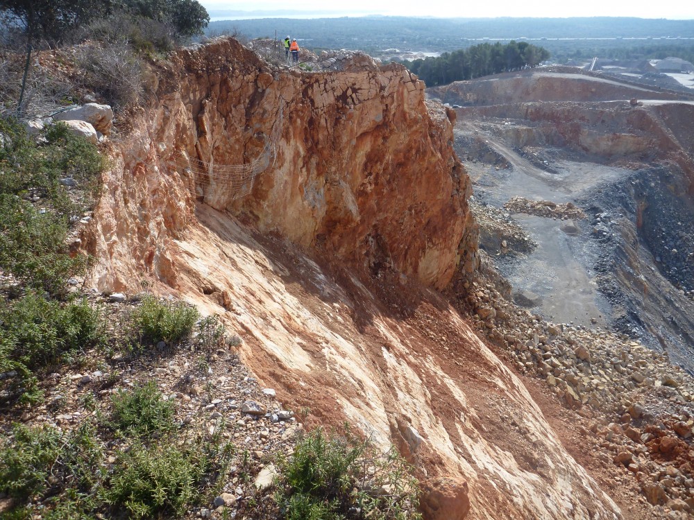 Services performed
- All our reconnaissances can be performed in difficult access situations, our teams are equipped with single rope technique
- Geophysical reconnaissances (seismic reflection, seismic refraction, tomography, hybrid seismic, geological radar, electrical prospecting, magnetism, etc.)
- Geotechnical stability studies of rocky slopes, geological expertise, structural measurements and analysis
- Study of the securing of infrastructures against rockfalls; sizing of active/passive protective structures
- Design and implementation of monitoring systems and management of rockfall risks.
- Traction conformity tests on anchoring bolts and tie-rods
- Laboratory tests on rock samples
Soil mechanics

Services performed
- In-situ geotechnical reconnaissance:
- Destructive core surveys with parameter recording, pressiometric surveys, CPT, SPT
- Heavy dynamic penetrometry and Panda
- Lugeon / Lefranc / Porchet permeability tests
- Traction conformity tests on anchoring bolts and tie-rods
- Geophysical reconnaissances (seismic reflection, seismic refraction, tomography, hybrid seismic, geological radar, electrical prospecting, magnetism, etc.)
- Laboratory tests on soil samples
- Identification tests
- Geomechanical tests
- Geotechnical study of earthworks, consolidation,
- Study of route tracing,
- Study of soil improvement
- Study of treatment against landslides
- Design and implementation of monitoring systems and management of landslide risks.
Superficial and deep foundation
From the study of the possibility of constructing an individual structure, up to the sizing of a complex foundation system for a building or a large size structure, GEOLITHE assists you with your project.
Services performed
- Sizing of surface or deep foundations, estimation of subsidence
- Reinforcement of deep foundations of structural works,
- Building foundations on compressible or liquefiable zones,
- Sizing of retaining walls supported by nails, tie-rods, piles,concrete
We use efficient, up-to-date and evaluated calculation programs for dimensioning geotechnical structures, such as:
Calculations
We use efficient, up-to-date and evaluated calculation programs for dimensioning geotechnical structures, such as:
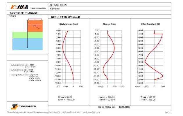
- Foundations, Shorings: GEOSPAR, KREA, GEOMUR
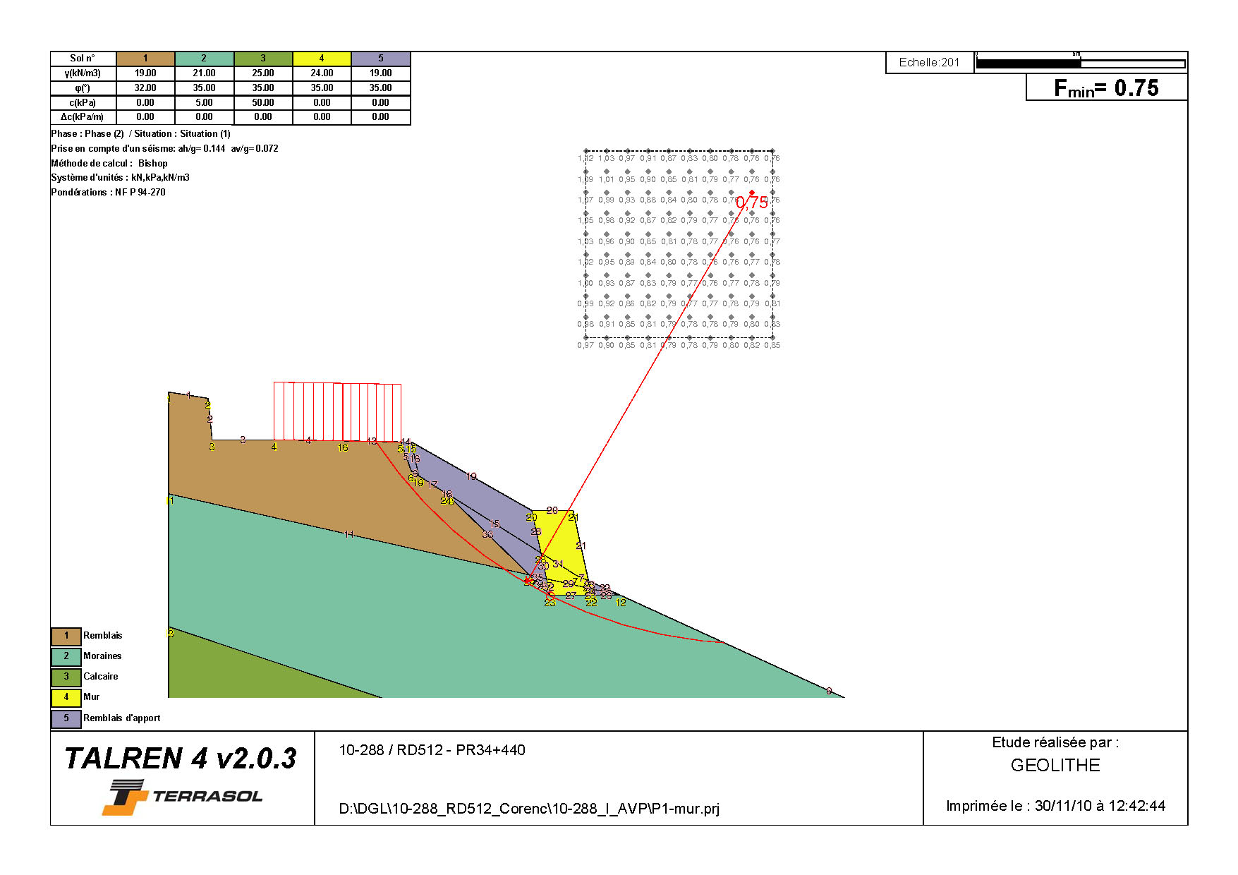
- Stability of slopes: Talren 4, SILEX (trajectography), GEODIEDRE and GEOPLAN
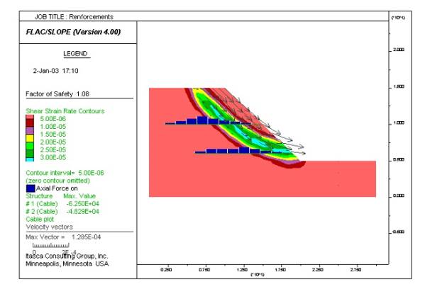
- Finite elements finis FLAC, FLAC3D, shoring curtains), PLAXIS
- Hydraulic flows PLAXFLOW