
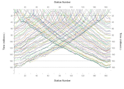
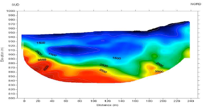
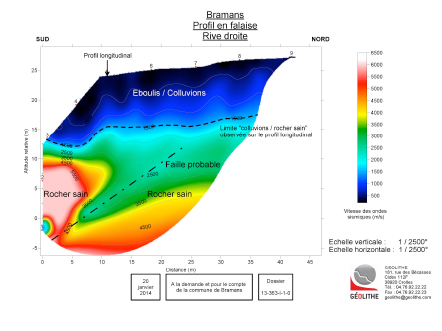
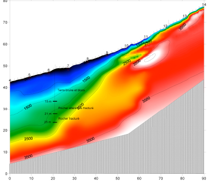
Result supplied
Seismic tomography allows the sub-soil or a structure to be imaged, either from the surface or from drill-holes and galleries. A cross-section of the spatial distribution of seismic speeds is obtained for the section by means of mathematical processing of all of the data.
Advantage of the method
This method allows zones to be determined at lower speed.
Applications
- Inspection of structural works, dams.
- Civil engineering: Reconnaissances for tunnels, dams, etc.
- Geological risk: Search for cavities.
- Underground storage
- Monitoring of injection work
- Resource : Prospecting for deposits of useful substances
Our Means
We use the program RAYFRACT which is one of the most efficient. Only GEOLITHE and BRGM have this software in France. We possess modern, efficient seismic laboratory systems which allow us to perform acquisitions with several hundreds of plots.