
Result supplied
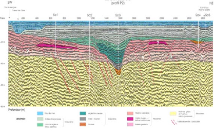
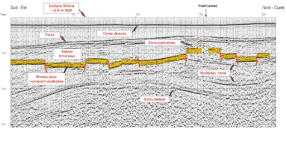
Seismic reflection allows a continuous, detailed image to be obtained of the horizontal and vertical structural extension of different geological horizons.
Investigation in depth
THR: from 0 to several hundreds of meters.
Applications
- Reconnaissance of surface sediments (geometry of deposits and correlations)
- Coastal layouts and river mouths
- Installation of marine structures and
- Sea floor mapping
- Search for granulates
Our Means
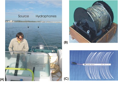
We use all types of seismic sources (Sparkers, Boomers, Air cannons, etc.) The digital acquisitions are performed with modern, efficient seismic laboratory systems (Delph Seismic, geometrics, etc.)